Inchon, 1950: The Landing Nobody Believed Possible
Battle Map Docs
43 views
September 15, 1950. The North Korean army has the UN forces cornered in a box around Pusan, and Douglas MacArthur wants to land 140 air miles behind it, at Inchon: a port the U.S. Marine Corps' own history calls "probably the least desirable objective" on the west coast, with tides of more than 31 feet, miles of mud at low water, one twisting channel, a fortified island in the middle of the harbor and stone seawalls instead of beaches. The Army and Navy chiefs flew in from Washington to question the plan; the admiral who had to carry it out said the best he could say was that it was "not impossible." This is the Inchon landing on one animated map: the tide tables that picked the date, the August 23 briefing in Tokyo, the Navy lieutenant who waded into the mud and relit a lighthouse, Wolmi-do on the morning tide, the twelve-hour wait, the ladders at Red Beach, the smoke at Blue Beach, Kimpo, Seoul, the link-up near Osan, and what it cost.
Subscribe for the next battle: https://www.youtube.com/@BattleMapDoc...
Where the sources disagree: tidal range "more than 31 feet" (Army history) vs spring tides of 23 to an occasional 33 feet (Marine history); landing craft needed 23 or 25 feet of tide; the fleet numbered more than 230 ships (Army) or 180 American and 60 allied (National Museum of the U.S. Navy); rockets before H-hour about 6,000 (Marine history) or 2,000 (Army); Doyle's words are recorded two ways ("The best I can say is that Inchon is not impossible" / "not impossible, but I do not recommend it"). MacArthur's words at the Tokyo briefing are given as the official histories reconstructed them from participants; his 1964 memoir version is longer.
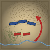
Map colors: blue is the UN side (U.S., South Korea and allies), red is the North Korean People's Army.
Chapters
0:00 Red Beach, 5:31 p.m.
0:33 The map
1:21 I. The back door
2:46 II. The worst harbor
5:05 III. Five-thirty in Tokyo
8:23 IV. Race to the tide
10:47 V. The morning tide
12:50 VI. The wall
15:44 VII. The anvil
18:18 What the map shows
18:51 Next: Saratoga, 1777
Sources
Roy E. Appleman, South to the Naktong, North to the Yalu (U.S. Army Center of Military History, 1961, CMH Pub 20-2-1): https://history.army.mil/
Lynn Montross & Nicholas A. Canzona, U.S. Marine Operations in Korea, vol. II: The Inchon-Seoul Operation (USMC, 1955): https://www.usmcu.edu/Portals/218/Mon...
Same text, Project Gutenberg: https://www.gutenberg.org/ebooks/65008
Naval History and Heritage Command, Inchon Invasion photo collection: https://www.history.navy.mil/
National Museum of the U.S. Navy, Inchon "The Task Force": https://www.history.navy.mil/content/...
USMC History Division, 1stLt Baldomero Lopez: https://www.usmcu.edu/Research/Marine...
JCS and MacArthur messages of 28 Aug and 8 Sept 1950 and Gen. J. Lawton Collins's 1951 Senate testimony, as quoted in the two official histories above.
Images
Naval History and Heritage Command / National Archives: NH 96876, NH 96877, NH 96379, NH 96980, NH 97053, NH 97152–97156; 80-G-419905, 80-G-420024, 80-G-420027, 80-G-420038, 80-G-420044, 80-G-420481, 80-G-421141, 80-G-423190, 80-G-423206, 80-G-423215, 80-G-426159, 80-G-467293; Army Signal Corps SC 348448 and USA C-2413.
U.S. National Archives / U.S. Marine Corps: 127-N-A3189 and 127-N-A3191 (SSgt. W. W. Frank), 127-N-A2739 (Sgt. Frank C. Kerr); NARA 531373 (U.S. Army).
Portraits: U.S. Army (J. Lawton Collins), U.S. Navy (Forrest P. Sherman, James H. Doyle), U.S. Marine Corps (Oliver P. Smith, Baldomero Lopez).
Maps, 3D terrain and animation drawn for this video; positions are a schematic reconstruction. Coasts and rivers: Natural Earth (public domain); relief: AWS Terrain Tiles (open data, modern elevation); the 1950 harbor plan is redrawn after the maps in the Marine Corps history. Illustrated scenes are labeled "Illustration"; they are not images from the time.
Next episode: Saratoga, 1777 — The Day Britain Lost an Entire Army.
#Inchon #KoreanWar #MilitaryHistory
1 Comments
Inchon, 1950: The Landing Nobody Believed Possible
Battle Map Docs
43 views
September 15, 1950. The North Korean army has the UN forces cornered in a box around Pusan, and Douglas MacArthur wants to land 140 air miles behind it, at Inchon: a port the U.S. Marine Corps' own history calls "probably the least desirable objective" on the west coast, with tides of more than 31 feet, miles of mud at low water, one twisting channel, a fortified island in the middle of the harbor and stone seawalls instead of beaches. The Army and Navy chiefs flew in from Washington to question the plan; the admiral who had to carry it out said the best he could say was that it was "not impossible." This is the Inchon landing on one animated map: the tide tables that picked the date, the August 23 briefing in Tokyo, the Navy lieutenant who waded into the mud and relit a lighthouse, Wolmi-do on the morning tide, the twelve-hour wait, the ladders at Red Beach, the smoke at Blue Beach, Kimpo, Seoul, the link-up near Osan, and what it cost.
Subscribe for the next battle: https://www.youtube.com/@BattleMapDoc...
Where the sources disagree: tidal range "more than 31 feet" (Army history) vs spring tides of 23 to an occasional 33 feet (Marine history); landing craft needed 23 or 25 feet of tide; the fleet numbered more than 230 ships (Army) or 180 American and 60 allied (National Museum of the U.S. Navy); rockets before H-hour about 6,000 (Marine history) or 2,000 (Army); Doyle's words are recorded two ways ("The best I can say is that Inchon is not impossible" / "not impossible, but I do not recommend it"). MacArthur's words at the Tokyo briefing are given as the official histories reconstructed them from participants; his 1964 memoir version is longer.
Map colors: blue is the UN side (U.S., South Korea and allies), red is the North Korean People's Army.
Chapters
0:00 Red Beach, 5:31 p.m.
0:33 The map
1:21 I. The back door
2:46 II. The worst harbor
5:05 III. Five-thirty in Tokyo
8:23 IV. Race to the tide
10:47 V. The morning tide
12:50 VI. The wall
15:44 VII. The anvil
18:18 What the map shows
18:51 Next: Saratoga, 1777
Sources
Roy E. Appleman, South to the Naktong, North to the Yalu (U.S. Army Center of Military History, 1961, CMH Pub 20-2-1): https://history.army.mil/
Lynn Montross & Nicholas A. Canzona, U.S. Marine Operations in Korea, vol. II: The Inchon-Seoul Operation (USMC, 1955): https://www.usmcu.edu/Portals/218/Mon...
Same text, Project Gutenberg: https://www.gutenberg.org/ebooks/65008
Naval History and Heritage Command, Inchon Invasion photo collection: https://www.history.navy.mil/
National Museum of the U.S. Navy, Inchon "The Task Force": https://www.history.navy.mil/content/...
USMC History Division, 1stLt Baldomero Lopez: https://www.usmcu.edu/Research/Marine...
JCS and MacArthur messages of 28 Aug and 8 Sept 1950 and Gen. J. Lawton Collins's 1951 Senate testimony, as quoted in the two official histories above.
Images
Naval History and Heritage Command / National Archives: NH 96876, NH 96877, NH 96379, NH 96980, NH 97053, NH 97152–97156; 80-G-419905, 80-G-420024, 80-G-420027, 80-G-420038, 80-G-420044, 80-G-420481, 80-G-421141, 80-G-423190, 80-G-423206, 80-G-423215, 80-G-426159, 80-G-467293; Army Signal Corps SC 348448 and USA C-2413.
U.S. National Archives / U.S. Marine Corps: 127-N-A3189 and 127-N-A3191 (SSgt. W. W. Frank), 127-N-A2739 (Sgt. Frank C. Kerr); NARA 531373 (U.S. Army).
Portraits: U.S. Army (J. Lawton Collins), U.S. Navy (Forrest P. Sherman, James H. Doyle), U.S. Marine Corps (Oliver P. Smith, Baldomero Lopez).
Maps, 3D terrain and animation drawn for this video; positions are a schematic reconstruction. Coasts and rivers: Natural Earth (public domain); relief: AWS Terrain Tiles (open data, modern elevation); the 1950 harbor plan is redrawn after the maps in the Marine Corps history. Illustrated scenes are labeled "Illustration"; they are not images from the time.
Next episode: Saratoga, 1777 — The Day Britain Lost an Entire Army.
#Inchon #KoreanWar #MilitaryHistory
Both official histories this episode is built on are free to read: the Marine Corps history (Montross & Canzona, 1955) is on Project Gutenberg: https://www.gutenberg.org/ebooks/65008