The Night Crossing That Saved the Revolution — Trenton, 1776
Battle Map Docs
76 views
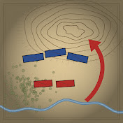
December 26, 1776, eight in the morning. Two American columns that parted four miles back, in a snowstorm, hit Trenton within minutes of each other. They were three hours late; Washington had already given up on surprise. This is the Trenton campaign on one animated map, hour by hour: an army days from going home, a plan for three river crossings of which only one got over, a night of ice on the Delaware, and a fight in the streets that lasted about half an hour. Plus what Leutze's famous painting gets wrong, and the one thing it gets right.
Subscribe for the next battle: @battlemapdocs
Where the sources disagree: Washington's own draft puts his force at about 2,400; Henry Knox wrote "about 2500 or three thousand." The Hessian garrison was about 1,500 by Washington's estimate, 1,447 in the three regiments by Stryker's count. Prisoners run from about 800 (American Battlefield Trust) through 896 (Fischer), 909 (Washington's report) and 918 (the enclosed return) to 948 (an NPS register nomination). Knox has the troops across by about 2 a.m.; Washington says 3 a.m. for the guns and nearly 4 before the march. American losses: Washington reported two officers and one or two privates wounded; his aide Tench Tilghman wrote of two killed; McCullough says two men froze on the march. Quotes that rest only on later recollection are flagged in the video or left out.
Chapters
0:00 Eight o'clock, December 26
0:33 The map
1:07 I. The army that was going home
3:12 II. The plan
6:09 III. The crossing
9:20 IV. The march
11:17 V. The fight in the streets
14:15 VI. The count
16:06 VII. What changed
18:29 Next: Chancellorsville
Sources
Washington to Hancock, 27 Dec 1776, with editorial notes (Knox, Wiederhold, Hull, Johnston, Tilghman, Stryker's figures): https://founders.archives.gov/documen...
General Orders, 25 Dec 1776: https://founders.archives.gov/documen...
Washington to Samuel Washington, 18 Dec 1776: https://founders.archives.gov/documen...
Washington to Joseph Reed, 23 Dec 1776: https://founders.archives.gov/documen...
Washington to Cadwalader, 25 Dec 1776: https://founders.archives.gov/documen...
Cadwalader to Washington, 26 Dec 1776 (with Thomas Rodney's account): https://founders.archives.gov/documen...
Washington to Hancock, 1 and 5 Jan 1777: https://founders.archives.gov/documen... · https://founders.archives.gov/documen...
Thomas Paine, The American Crisis, No. 1 (1776)
Jett Conner, "The American Crisis Before Crossing the Delaware?", Journal of the American Revolution: https://allthingsliberty.com/2015/02/...
David Hackett Fischer, Washington's Crossing (Oxford, 2004)
William S. Stryker, The Battles of Trenton and Princeton (1898)
Edward J. Lowell, The Hessians (1884), ch. 8
Mount Vernon, Battle of Trenton: https://www.mountvernon.org/library/d...
Mount Vernon, 10 Facts about Washington's Crossing of the Delaware: https://www.mountvernon.org/george-wa...
American Battlefield Trust, Trenton: https://www.battlefields.org/learn/re...
American Battlefield Trust, Washington's artillery in the Ten Crucial Days: https://www.battlefields.org/learn/ar...
National Park Service, John Glover: https://www.nps.gov/articles/000/john...
National Museum of the U.S. Army, Crossing the Delaware: https://www.thenmusa.org/articles/cro...
Images
Emanuel Leutze, Washington Crossing the Delaware, 1851 (97.34): https://www.metmuseum.org/art/collect...
Charles Willson Peale, George Washington, ca. 1779–81 (97.33): https://www.metmuseum.org/art/collect...
Claude Joseph Sauthier, A Plan of Operations of the King's Army, 1777 (24.90.1330): https://www.metmuseum.org/art/collect...
All three: The Metropolitan Museum of Art, public domain (Open Access).
Plan of the operations of General Washington against the King's troops in New Jersey, 1777: Library of Congress, Geography and Map Division, https://www.loc.gov/item/gm71000654/
Maps and animation drawn for this video; positions are a schematic reconstruction. Coasts, rivers and state lines: Natural Earth (public domain); creeks and 1776 roads drawn approximately. Illustrated scenes are labeled "Illustration"; they are not images from the time.
Next episode: Chancellorsville, 1863 — The Retreat That Was a Trap.
#BattleOfTrenton #AmericanRevolution #MilitaryHistory
1 Comments

The Night Crossing That Saved the Revolution — Trenton, 1776
Battle Map Docs
76 views
December 26, 1776, eight in the morning. Two American columns that parted four miles back, in a snowstorm, hit Trenton within minutes of each other. They were three hours late; Washington had already given up on surprise. This is the Trenton campaign on one animated map, hour by hour: an army days from going home, a plan for three river crossings of which only one got over, a night of ice on the Delaware, and a fight in the streets that lasted about half an hour. Plus what Leutze's famous painting gets wrong, and the one thing it gets right.
Subscribe for the next battle: @battlemapdocs
Where the sources disagree: Washington's own draft puts his force at about 2,400; Henry Knox wrote "about 2500 or three thousand." The Hessian garrison was about 1,500 by Washington's estimate, 1,447 in the three regiments by Stryker's count. Prisoners run from about 800 (American Battlefield Trust) through 896 (Fischer), 909 (Washington's report) and 918 (the enclosed return) to 948 (an NPS register nomination). Knox has the troops across by about 2 a.m.; Washington says 3 a.m. for the guns and nearly 4 before the march. American losses: Washington reported two officers and one or two privates wounded; his aide Tench Tilghman wrote of two killed; McCullough says two men froze on the march. Quotes that rest only on later recollection are flagged in the video or left out.
Chapters
0:00 Eight o'clock, December 26
0:33 The map
1:07 I. The army that was going home
3:12 II. The plan
6:09 III. The crossing
9:20 IV. The march
11:17 V. The fight in the streets
14:15 VI. The count
16:06 VII. What changed
18:29 Next: Chancellorsville
Sources
Washington to Hancock, 27 Dec 1776, with editorial notes (Knox, Wiederhold, Hull, Johnston, Tilghman, Stryker's figures): https://founders.archives.gov/documen...
General Orders, 25 Dec 1776: https://founders.archives.gov/documen...
Washington to Samuel Washington, 18 Dec 1776: https://founders.archives.gov/documen...
Washington to Joseph Reed, 23 Dec 1776: https://founders.archives.gov/documen...
Washington to Cadwalader, 25 Dec 1776: https://founders.archives.gov/documen...
Cadwalader to Washington, 26 Dec 1776 (with Thomas Rodney's account): https://founders.archives.gov/documen...
Washington to Hancock, 1 and 5 Jan 1777: https://founders.archives.gov/documen... · https://founders.archives.gov/documen...
Thomas Paine, The American Crisis, No. 1 (1776)
Jett Conner, "The American Crisis Before Crossing the Delaware?", Journal of the American Revolution: https://allthingsliberty.com/2015/02/...
David Hackett Fischer, Washington's Crossing (Oxford, 2004)
William S. Stryker, The Battles of Trenton and Princeton (1898)
Edward J. Lowell, The Hessians (1884), ch. 8
Mount Vernon, Battle of Trenton: https://www.mountvernon.org/library/d...
Mount Vernon, 10 Facts about Washington's Crossing of the Delaware: https://www.mountvernon.org/george-wa...
American Battlefield Trust, Trenton: https://www.battlefields.org/learn/re...
American Battlefield Trust, Washington's artillery in the Ten Crucial Days: https://www.battlefields.org/learn/ar...
National Park Service, John Glover: https://www.nps.gov/articles/000/john...
National Museum of the U.S. Army, Crossing the Delaware: https://www.thenmusa.org/articles/cro...
Images
Emanuel Leutze, Washington Crossing the Delaware, 1851 (97.34): https://www.metmuseum.org/art/collect...
Charles Willson Peale, George Washington, ca. 1779–81 (97.33): https://www.metmuseum.org/art/collect...
Claude Joseph Sauthier, A Plan of Operations of the King's Army, 1777 (24.90.1330): https://www.metmuseum.org/art/collect...
All three: The Metropolitan Museum of Art, public domain (Open Access).
Plan of the operations of General Washington against the King's troops in New Jersey, 1777: Library of Congress, Geography and Map Division, https://www.loc.gov/item/gm71000654/
Maps and animation drawn for this video; positions are a schematic reconstruction. Coasts, rivers and state lines: Natural Earth (public domain); creeks and 1776 roads drawn approximately. Illustrated scenes are labeled "Illustration"; they are not images from the time.
Next episode: Chancellorsville, 1863 — The Retreat That Was a Trap.
#BattleOfTrenton #AmericanRevolution #MilitaryHistory