Por que NENHUM outro estado é como o Acre
O Mapa Não Mente
90,962 views
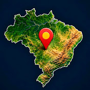
In 1867, Brazil itself signed a treaty recognizing that the land belonged to Bolivia. In 1900, it returned it. Three years later, it paid 2 million pounds sterling to keep it. The map shows why no other state is like Acre.
In this video:
• The straight line from 1867 that said: Bolivia
• The myth of the horse
• The rivers that carried people from Ceará and the Northeast to the rubber plantations
• Luis Gálvez, Plácido de Castro and the Acrean Revolution
• The Treaty of Petrópolis and the Madeira-Mamoré Railway
• Chico Mendes, the geoglyphs and the giant alligator
• Acre as Brazil's gateway to the Pacific
Also watch: Why NO other state is like Ceará → [LINK TO THE CEARÁ VIDEO]
The map doesn't lie.
SOURCES
Treaty of Ayacucho (1867) and Treaty of Petrópolis (1903); National Historical Museum (Acrean Question); Portal Amazônia; Sesc SP (The Land of the Rubber Plantations); FAPESP Research Magazine and Iphan (geoglyphs); IBGE (2022 Census, 2023 Regional Accounts, extreme points); Rio Branco Civil Defense; Law 4.070/1962; Law 11.662/2008, 2010 referendum and Law 12.876/2013 (time zone); Datamar News (Pacific route). Straight-line distances calculated by the channel.
PHOTO CREDITS (public domain, via Wikimedia Commons)
• Madeira-Mamoré Railway (2 photos): Dana Merrill, Collection of the Paulista Museum of USP
• Plácido de Castro: The Brazilian Homeland (Virgílio Cardoso de Oliveira)
• Baron of Rio Branco: unknown author
• Luis Gálvez: unknown author
ILLUSTRATIONS
The historical and landscape scenes are digital artistic illustrations, not photographs.
MAP CREDITS
Satellite image: Sentinel-2 cloudless - https://s2maps.eu by EOX IT Services GmbH (Contains modified Copernicus Sentinel data 2016 & 2017), CC BY 4.0. Relief: Terrain Tiles (Mapzen/AWS), with SRTM and GMTED2010 (USGS) and ETOPO1 (NOAA) data. Boundaries: IBGE and Natural Earth.
#Acre #HistoryOfBrazil #TheMapDoesntLie
19 Comments
Um abraço aqui de Uberlândia MG.
Ótimo video
meira República (1889 - 1930) SÓ QUE !!! no caso do Acre, foram os camponeses dos seringais!!! dos "coronéis de barranco" (nome dado aos proprietários dos seringais, também chamados de Seringalistas, e Barões da Borracha!!!)
Principais equivalências:
• Em metros quadrados: 1 acre = ~4.047 m²
• Em hectares: 1 acre = ~0,404 ha (ou 1 hectare equivale a cerca de 2,47 acres)
• Formato visual: Se representado em um quadrado, tem cerca de 63,6 metros de lado.
• Uso: É uma medida comum nos Estados Unidos, no Reino Unido e em outros países de língua inglesa, diferentemente do Brasil, onde o padrão oficial é o hectare
Por que NENHUM outro estado é como o Acre
O Mapa Não Mente
90,962 views
In 1867, Brazil itself signed a treaty recognizing that the land belonged to Bolivia. In 1900, it returned it. Three years later, it paid 2 million pounds sterling to keep it. The map shows why no other state is like Acre.
In this video:
• The straight line from 1867 that said: Bolivia
• The myth of the horse
• The rivers that carried people from Ceará and the Northeast to the rubber plantations
• Luis Gálvez, Plácido de Castro and the Acrean Revolution
• The Treaty of Petrópolis and the Madeira-Mamoré Railway
• Chico Mendes, the geoglyphs and the giant alligator
• Acre as Brazil's gateway to the Pacific
Also watch: Why NO other state is like Ceará → [LINK TO THE CEARÁ VIDEO]
The map doesn't lie.
SOURCES
Treaty of Ayacucho (1867) and Treaty of Petrópolis (1903); National Historical Museum (Acrean Question); Portal Amazônia; Sesc SP (The Land of the Rubber Plantations); FAPESP Research Magazine and Iphan (geoglyphs); IBGE (2022 Census, 2023 Regional Accounts, extreme points); Rio Branco Civil Defense; Law 4.070/1962; Law 11.662/2008, 2010 referendum and Law 12.876/2013 (time zone); Datamar News (Pacific route). Straight-line distances calculated by the channel.
PHOTO CREDITS (public domain, via Wikimedia Commons)
• Madeira-Mamoré Railway (2 photos): Dana Merrill, Collection of the Paulista Museum of USP
• Plácido de Castro: The Brazilian Homeland (Virgílio Cardoso de Oliveira)
• Baron of Rio Branco: unknown author
• Luis Gálvez: unknown author
ILLUSTRATIONS
The historical and landscape scenes are digital artistic illustrations, not photographs.
MAP CREDITS
Satellite image: Sentinel-2 cloudless - https://s2maps.eu by EOX IT Services GmbH (Contains modified Copernicus Sentinel data 2016 & 2017), CC BY 4.0. Relief: Terrain Tiles (Mapzen/AWS), with SRTM and GMTED2010 (USGS) and ETOPO1 (NOAA) data. Boundaries: IBGE and Natural Earth.
#Acre #HistoryOfBrazil #TheMapDoesntLie